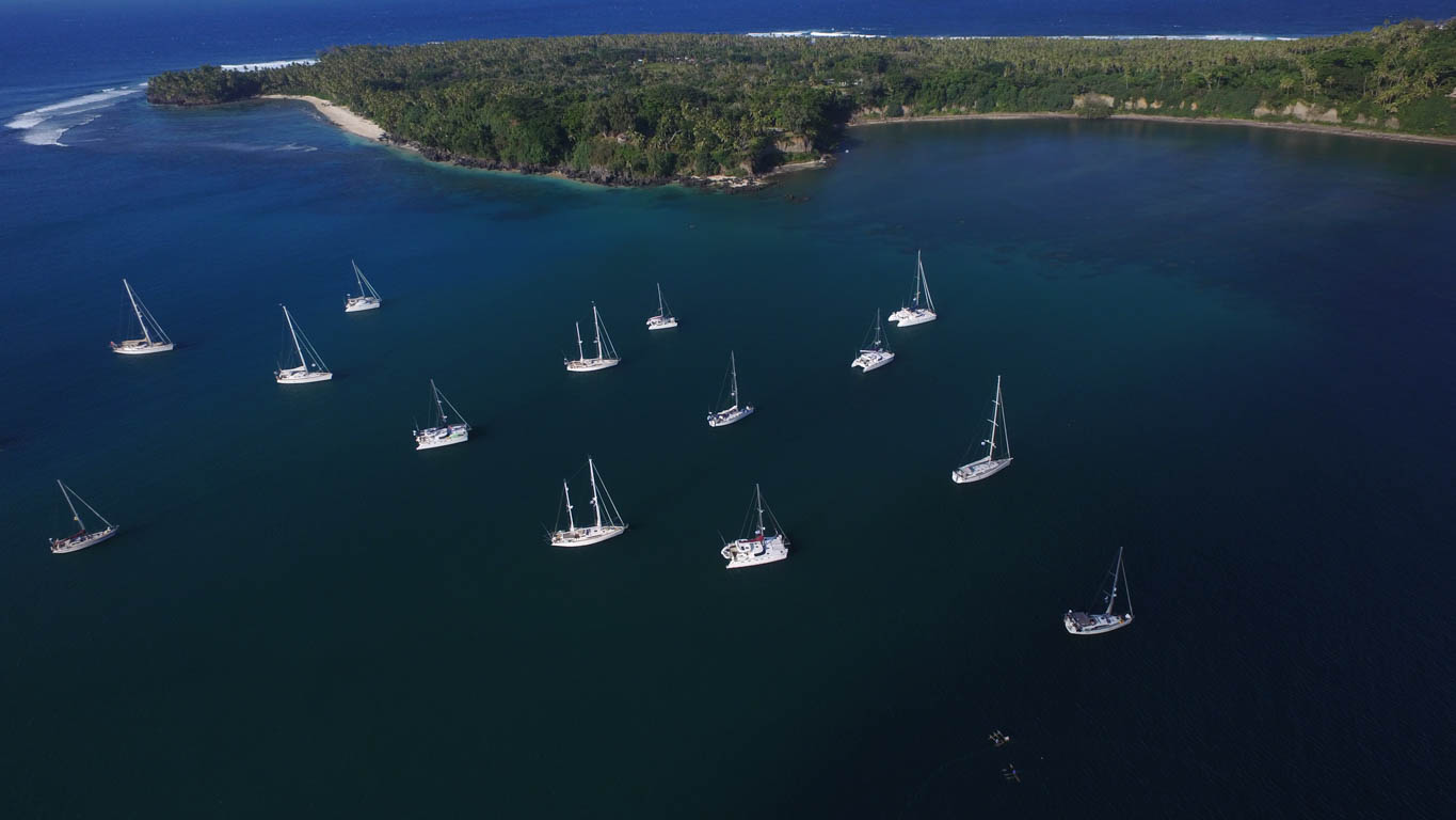
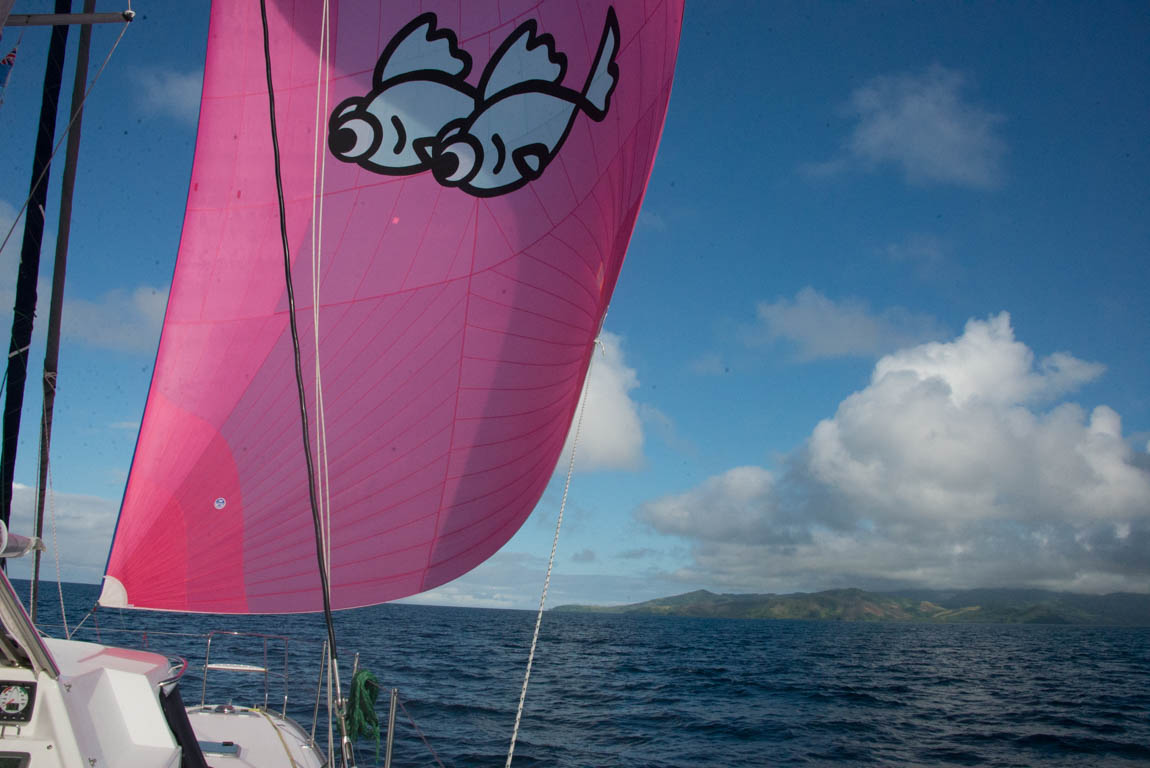
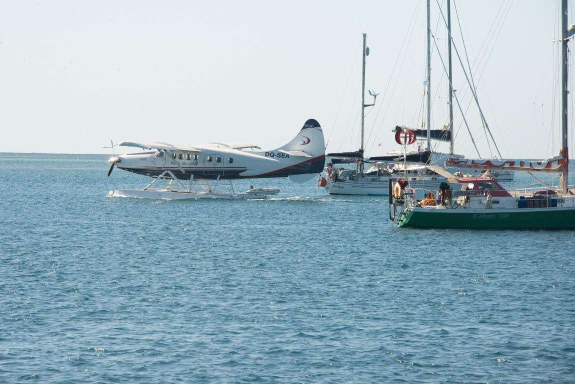
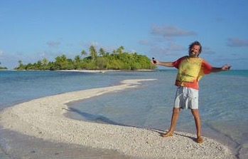
In 1992, I (Jason) sailed from New York to Florida; our GPS was a white brick attached to the lifelines that only displayed a Lat and Lon. It was not networked, it had no charts or graphics, but it seemed like wonder technology. It cost $1,000. Six days after leaving the dock it beeped at the right time for our approach mark to West Palm Beach.
Now iOS apps offer a myriad of features, including GPS. Many have been tested aboard Two Fish. Here is a list of the must haves, the OKs and the duds.
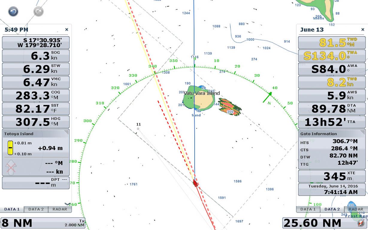
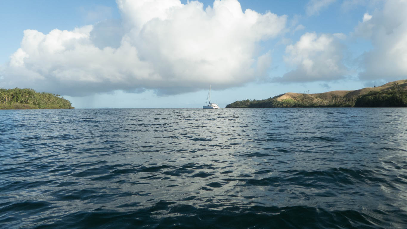
I think blue water cruisers are much safer with a proper chart plotter at the wheel. If there had been a chart plotter on team Vestas they might have avoided the reef. However, iOS apps offer many features and cheaper pricing, so they can be a primary for a budget cruiser and a back up on a decked-out boat.
This post is rather long so here is the MUST HAVE LIST
- An anchor drag alarm: Anchor
- NMEA data view (NMEA to wifi hardware required): Edo Instruments by Seamantech
- Weather app: Weather Track
- Navigation app: Navionics
- Reference Programs
Anchor Drag Alarm
Anchor
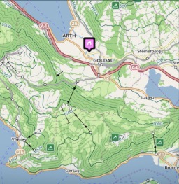
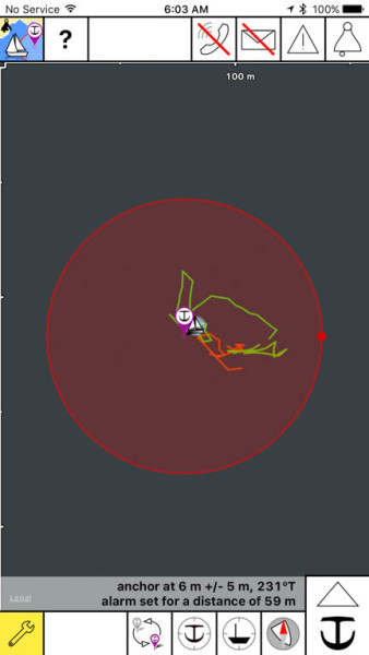 The iOS app Anchor (link to iTunes store) best addresses our fear of dragging anchor while asleep on windy nights. After dropping hook, you input into the app the distance to the anchor, the bearing to the anchor and the size of the safety circle. It works without cell towers but if you are lucky enough to have an internet connection then you will see your location on a satellite view. The photo to the left was taken without internet and in light air with current. When the breeze built, the boat headed to the edges of the circle, but in light air we sat on the anchor. The purple arrow is the anchor, the boat is Two Fish and the red circle is the drag alarm range. The great feature of this app is the ability to view the history of your location. When you feel a big puff or a weird sensation in the middle of the night, you can quickly check the app and confirm the boat is still on the same arc. I still go on deck to survey, but now my second wake up only requires a quick glance at the app. A feature we don’t use because we often lack cell signal is messaging. An iPhone with the Anchor app can SMS or email another iPhone onshore if the boat is dragging. What do you do when you are four hours away on a hike and you get a message that the boat is dragging? The only shortcoming of the app is a lack of an alarm for wind shifts. This would be good in tidal streams or when you are counting on the trade winds. The apps draws down the battery so we sleep with the iPhone plugged into our 12 volt USB outlets. We have not experienced app crashes, but in tricky anchoring spots we will have both iPhones running the app. Works on an iPad as well. Must have app, will make anchoring much more relaxing.
Other apps we tested:
Boat Sentry: This app was a runner up for our needs. It has the ability to warn you of 180 degree shifts via a very flexible set of menus. Not the easiest app to learn but powerful. However it lacks the satellite view feature, which I found very useful when we had a internet connection.
Drag Queen: Sassy name for the app but it lacks a graphical interface. Prefer an easier format to read when being woken up at 2 am. Skip this app.
Our chart plotter has a simple anchor alarm but we do not use it because keeping the chart plotter on consumes too much electricity and the alarm noise is soft. We bought our AIS for its low power anchor alarm but had to wait 3 years for the feature to become part of the software. Even now, the iPhone alarms seem to dominate.
Wind Alarm
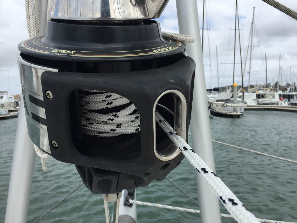
When anchored in Tonga, a gust hit our anchorage. Our friends were woken up by an alarm warning them of the gusts. The AIS confirmed that our friends were not dragging, but they saw another nearby boat traveling at 2.5 knots. The other boat was dragging for sure. We organized a rescue party and the boat was re-anchored. Now on Two Fish we have a rule that 100% of the time at anchor or on a mooring ball we leave on the AIS and the wind alarm. If I have anchored in light air, I will set the alarm at 25 knots. If I am woken up and confirm all is good I reset the alarm at 5 knots higher. With the AIS turned on we get two advantages: first, late night arrivals to the harbor can see Two Fish, and second, our instrument data is sent out via wifi, a segue into reviewing the group of apps that can display wifi NMEA data on iOS. For non-techies, NMEA is the name for the data interface used to communicate between a boat’s data display instruments.
NMEA Data Viewer Apps
iRegatta
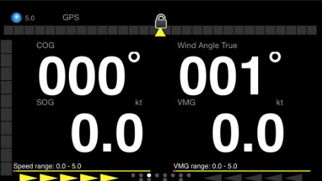
I like the ability while sailing or at anchor to quickly look at key data. Wind speed, depth and true wind angle are favorites. iRegatta will display most NMEA data transmitted on a wireless IP address. In other words, if your chart plotter or AIS or add-on device transmits the NMEA data wirelessly, you can use this application. It is a bit like a chart plotter in your pocket. It will also show AIS targets and try to calculate your polars. This did not work for me, but it might be my fault. I have used the app for a few years and it is a must have for me but there may be a better solution.
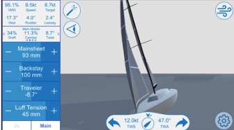
Seamantech (EDO Instruments)
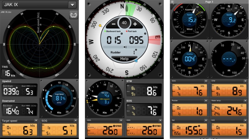
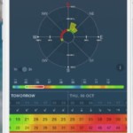
I just started using EDO instruments by Seamantech. I give it a 10 out of 10 rating. It is early days, but I think it will displace my regular use of iRegatta because of its more pleasing layout. The app can also efficiently calculate polars by recording data (wind speed, wind angle and boat speed) while sailing. Over time, with enough data, the app will plot the top speeds for each angle and wind speed. The user can correct the app if you think the data was corrupted by current or by surfing a wave. You can also create different polars for different sail plans so you can really know the cost of tucking in the second reef. Sounds like I will be busy doing some data recording next season.
By the way, rumor is they are coming out with a brand new app.
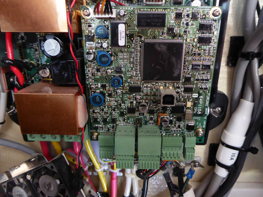
Furuno Chart plotter App
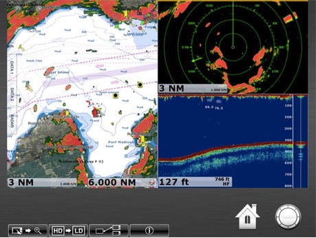
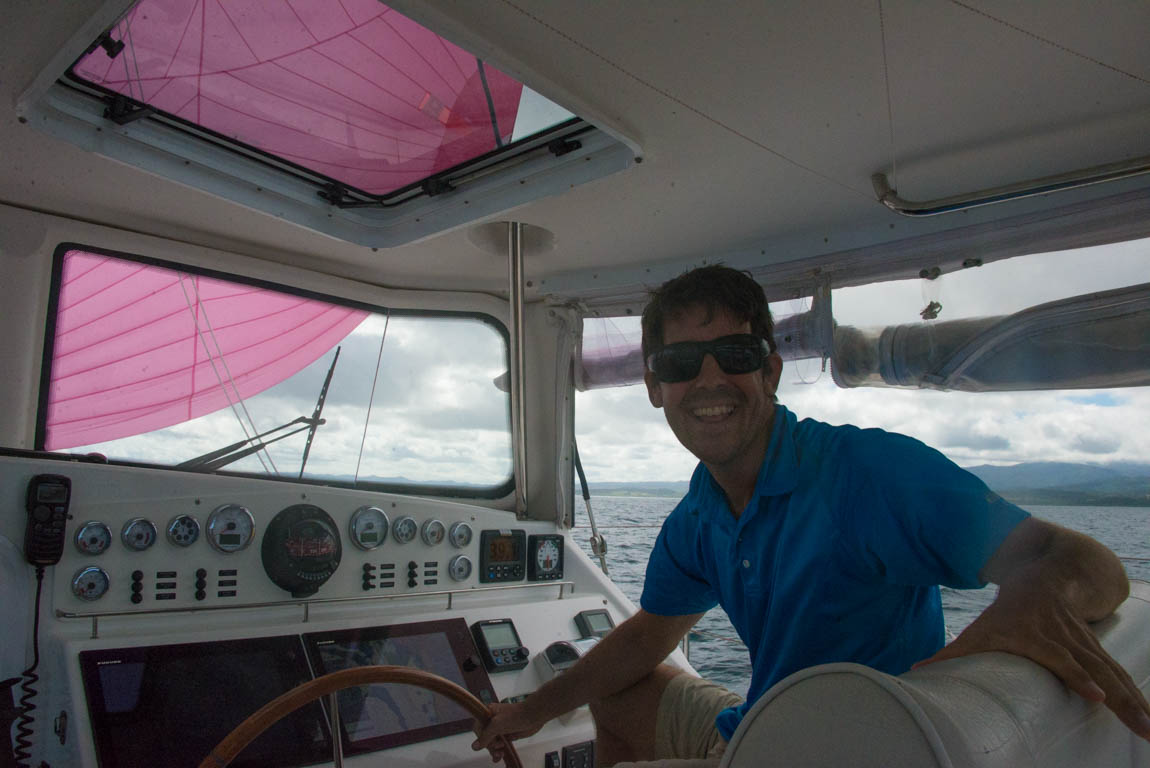
Furuno offers two apps that run on both iPhones and iPads. After paying a king’s ransom for the hardware, the app is free. The first is very useful and allows a duplicate image of the chart plotter to appear on the iPhone. During my off-watch I enjoy checking on the helm without getting out of bed. Don’t worry, someone else is always at the helm on Two Fish. I can see the radar and then change screens and see the chart with all of the wind data, course information, rudder angle and depth. Whenever I connect the app, the chart plotter beeps, warning the helms person that big brother is spying. I have disabled the ability for an app user to adjust the chart plotters. This was a Gail requirement. If you are lucky enough to have Furuno TZ’s, this gives you an extra chart plotter in the cabin, in the galley or even down in the bilge. This is a most powerful app, but I only use it when sailing since I don’t want to run the chart plotter while at anchor. As a side note, I often notice large sport fish boats will leave their chart plotters on when docked with no one on board. What’s up with that? Furuno has another free app, NavNet Viewer, which streams data from the network. It is passable but I prefer Seamantech’s viewer mentioned before.
Weather Apps
Most weather apps are driven by the same NOAA-produced GFS forecast data. I have watched people open up four weather apps to reassure themselves of the weather for their upcoming trip, yet the apps are all using GFS data. So at times, what distinguishes them is presentation.
Some apps do allow a switch to the European model or the Canadian model. For no good reason, we tend to prefer the GFS model. Additionally, Wind Guru and Predict Wind both massage the data, but I tend not to value their efforts. I do not connect my iOS devices to the web while at sea, so I only use these apps while lingering onshore at our lunch stop before long trips. If I see another sailor, we might grunt about the forecast being interesting, code word for lousy weather.
I do not value forecasts beyond 48 hours. But we will delay if the forecast has seas on the nose of greater than 3 meters, wind on the nose of greater than 20 knots, and wind abeam or behind of greater than 35 knots.
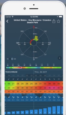
Weather Track
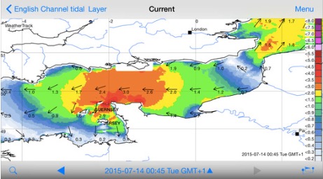
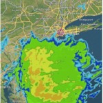
Weather Track has all of the data I need to plan a passage. Wind speed, wind gusts, wave height and direction, ocean current, rain, lightning and more. I find the display easy to read. The program does some smart fetching of data from different servers. It also has a passage planning feature which I do not use, because I prefer Predict Wind’s routing. At sea, Weather Track coupled with X Gate can retrieve recent forecasts via SSB or Iridium phones. We use SailMail while at sea, so I can’t review this feature. Ocean currents are included with Weather Track, a feature which many apps lack. The source is OSCAR which replaces my earlier tedious downloading of the PDF’s from the government server. (click here to see my 2014 post describing our use of OSCAR in Brazil) Feeding the data go straight into the app is deluxe. Additionally, you can purchase more detailed currents from TideTech. Weather Track is a must have application.
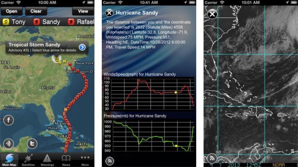
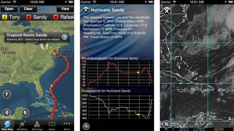
Hurricane Tracker by Gencode: We have tried to stay out of Hurricane regions, however, they can cross the path of the most careful sailor. They arrive while your boat is on the hard or during a late trip down the US coast bound for the BVI. We also watch the big hurricanes and hope they do not hurt our wonderful hosts on so many Caribbean islands.
Wind Guru
This app is rather ugly and was the benchmark years ago. It looks like it is a shrunken web page rather than a full blown app. While visiting Uruguay we asked the Coast Guard about good weather since the national weather bureau was on strike. The Coast Guard handed us a print out from the wind guru website. The app market has moved on and this app is extinct and Windy replaces it with better presentation and more power. We view this website when in one location wondering if it will be a windy week at anchor rather than for passage planning.
Windy
Windy has a beautiful set-up and is good for single spot monitoring. Is it going to be too windy at my anchorage this week for paddleboarding? Will it rain during the shoreside BBQ? These are important questions in my life. I realize there are plenty of similar apps in this crowded space but this one works best for me. I wish it had radar and weather buoys.
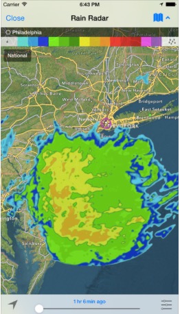
Willy Weather
Willy Weather has radar and tides. Since the Furuno radar is pretty good at showing rain cells we do not use online radar too often. However, when I am on smaller boats without radar it adds a nice measure of safety to have access to radar. Tide tables are built into our chart plotter so we tend not to use other apps frequently for tide data. In locations with massive tidal concerns I prefer to get the tide tables from the local authority. We still carried an Eldridge guide while cruising the US east coast.
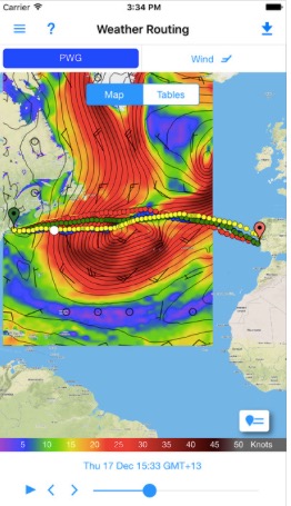
Predict Wind
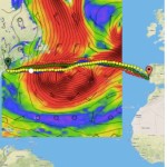 This app does not compete with the above weather apps. It has a few nice features that address the offshore sailor. First the app works easily with Iridium Go. This is one of its key features, so if you have a cell signal this app is less interesting. Secondly the app does weather routing, which is only useful for longer trips. If you have both of those needs I can recommend the app. Its Iridium Go usage is efficient and it has a decent GRIB viewer. The interface is much friendly than the free service from Sail Docs. It lacks gusts in the weather planning module, which is a big oversight, In addition, the cost for a subscription is not tiny.
Navigation
Navionics
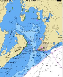
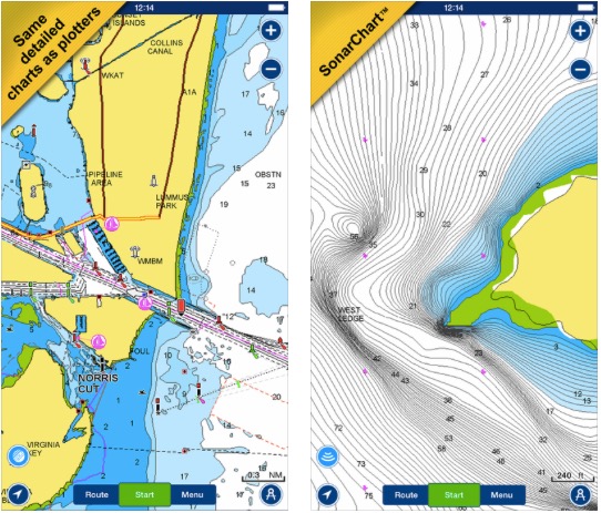 I use this app frequently for a variety of reasons. It is great to have when onshore and another sailor tells you of a great bay or an unmarked sand bar. The alternative, carrying your chart plotter, is not very easy. I also do some light planning on the phone. It has an auto router which I do not use, but it is good for a quick check. Just tell it your start and finish and the router will honor all the appropriate markers. It also has tides, moon, sun, simple weather data and a basic logbook. For 22$ you can buy the entire Pacific islands. Raises the question of how long chart plotter companies can continue to kill us with such high prices. Navionics also tries to have crowd sourced information but it pales in comparison to Active Captain. They also have more detailed sonar charts which is pretty useful for those going down the ICW. Must buy.
Blue Chart Mobile
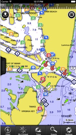
The only reason we bought Blue Chart Mobile is that it includes Active Captain. It was convenient wile transiting the ICW to have the anchorage, shoaling and other navigation warnings in my pocket. Blue Chart has a friendly interface but leaves out key features to protect their chart plotter offerings. The app does not display boat speed. Are you kidding me? A sometimes useful feature is the ability to edit the position of user-input spots. For some reason, once a new spot is put on the Navionics chart, it can’t be altered. We have and use both apps but I prefer Navionics. Buy this app if you value Active Captain data. There are some other Active Captain enabled apps (see the Active Captain website for the most recent list).
iNavX
 Why in the world would I want a third mini chart plotter app? iNavX offers two things that neither of the big brothers offer. First, it can display raster charts containing the Explorer Chart guide to the Bahamas. These guides are by far the best for Bahamian cruising. This is superior to a hard copy book since it allows for the live location of Two Fish. Secondly, iNavX can display my entire NMEA network data. From wind speed to AIS targets. Nice as another back up. Recommendation: only buy if cruising the Bahamas.
Transas iSailor
 Very little experience with this app since it costs a bunch to open up all the features. Pay for AIS, NMEA, charts etc. Uses a type of vector chart common in the programmer’s home country of Russia. App has a clean, yet not stunning interface. Looks to have nice apple watch integration but I don’t have an apple watch. Recommendation: Get a more detailed review from a power user.
Marine Traffic
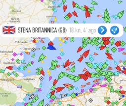
Ever wonder where the boat you met a year ago has traveled to? Want to know more about that huge ship that passed in the channel? Marine Traffic uses AIS data to track other boats’ histories and additional data. Add friends to the fleet and the app will tell you when they make a new landfall. Does not help you navigate but helps you stay in touch. Must have for amusement.
Marine Brazil
This featureless app offers free raster charts for Brazil. We carried it as a back-up for our time in Brazil but never used it. Recommendation: Its free, why not, if you are going to Brazil.
Tides Planner by Imray There are several tide planning apps and tide tables come with navigation apps. But what is the data source? My watch proudly announces the tides for our current location and it is often horribly off from reality. Tides are very local and some apps try to use lat / lon to calculate tides via formulae. That does not work.
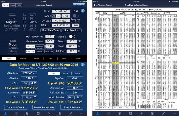
Celestial Navigation
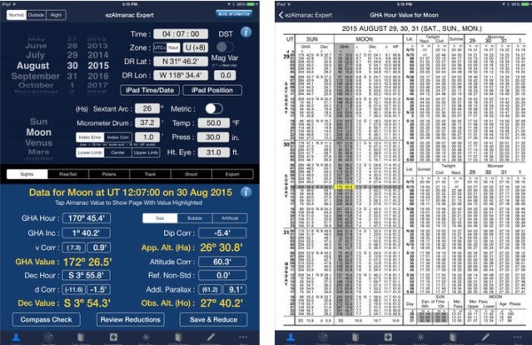
EZ Sights and EZ Almanac help make the complex game of celestial navigation less confusing. The apps offer the user two approaches. The first approach is to type in the observed angle of the object, and the rest is done for you in the app. The second approach is to look through the same printed tables that are in the books and complete the calculations as if on paper. I still struggle with either technique. I do realize that if my iPad is key to using the sextant, I am not free from power failure vulnerability. I bought the app to help me become a celestial navigator. I have failed, but no fault is due to the app.
Logbook
I have tried WaveTrax and the log feature inside Navionics. The former dedicated logbook app was a huge let down. It is no longer in the app store for good reason. Navionics’ log book feature is great for a two hour day sail, but if you run it for days it eventually crashes. I wish Furuno had a logbook feature. It seems like an easy app to write. If any readers of the blog know of a better solution, drop me a line. Until then, I will use the pen and store my GPX files from the Furuno.
NavPlay is a multi-feature navigation app which has a log book feature but I have been let down twice and am shy on spending fifty bucks for another flop. I asked Gail if she wants to write our own logbook app. Start the 7 year wait for the app.
Reference Books
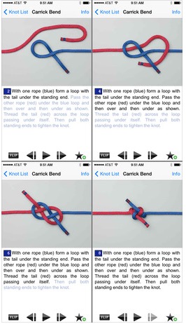
Grog Knots
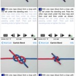 I forget key knots and can not spell but computers have come to my rescue. Spell checker for one problem and Grog Knots for the other. Easy to follow animations make rope klutzes into natural born bowline makers. Carrying this “book” on the iPhone saves space on the book shelves.
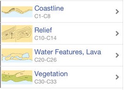
Marine Chart Symbols by Imray
As a US Coast Guard Vessel, we are required to carry a book that lists all of the chart symbols. That makes this app redundant, but when bored it is fun to quiz yourself on odd chart symbols. While on the topic of chart symbols, remember that green “land” is very dangerous. It will can have a depth of less than one meter except it looks like normal navigable water. It is easy to get confused when looking at the chart thinking the visible land is the end of the island and accidentally short cut across the shallow green area. If you see green on the chart, think twice. Not a required app to buy.
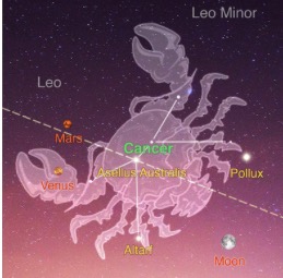
Starwalk

When watching the phosphorescence illuminate your wake becomes boring, it is time to use Starwalk. Hold the app up to the stars and it will tell you the names of the objects. You can impress your crew mates by identifying the planets, constellations and even the International Space Station. Not a required app but what else are you going to do during the night on multi-day passages?
Barograph
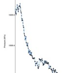
We use GRIB files frequently to keep ourselves out of nasty weather and the traditional barometer has taken a back seat. Recently I have elevated the barometer in my weather tool kit. Any iPhone 6 or later has a built-in barometer that was added not for weather forecasters, but to help in speeding up GPS fixes. Barograph is the only app I found that graphs the pressure, but it lacks a calibration feature. I have compared the iPhone to four other sources and it seems within 2 millibars of the other sources. Must buy if you have no other barometer on board. My preferred barometer is my Garmin Fenix 3 watch and my least favorite is the fancy Weems and Plath.
Pocket Earth
 Our friends from another Antares, Echo, tipped us off on this great app. When hiking or exploring new towns, it is nice to have maps but often you have no cell signal or lack a local sim card. Pocket Earth has decent maps which we used in the Galapagos, Las Perlas Islands and French Polynesia. Very helpful when lost on a hike and the sun starts to dip. Just remember to download the data for each country while you still have wifi.
Boat Maintenance
SIM Yamaha: A simple app that helps in the ordering of parts for our reliable outboard. Helps finding part numbers. It is free so you might as well use it if you have a Yamaha.
Volvo Penta Dealer Locator: Saves time when looking for a real Volvo dealer. We are picky when we ask for professional help on our engines. Only pros are allowed on board. It doesn’t have all the dealers, but it is a good start.
Boat Owners Mechanical and Electrical Manual by Nigel Calder: Originally this book was made into an app but now it is for sale in e-book format. I would prefer the hard copy but if you are low on space, at least travel with the e-book.
Boater’s Pocket Reference is another book to app transformation. It is good but I would hold off if you have a strong boat library on board already.
Travel
 The Islands of Tahiti: Official Guide is a government sponsored ad for tourism. If you travel to buy a T-shirt and go to Hard Rock this is the app for you. Else, stick with Soggy Paw’s compendiums. They are much better and written by and for cruisers. They are simple PDF’s but will enhance your Pacific crossing.
Antoine in the Tuamotos Islands: Antoine is “the famous singer / sailor in the yellow catamaran Bannana Split”. I bought this app for comedic value but it fell short. Again, stick with the compendiums.
Collins English French Dictionary A French, Spanish and Portuguese dictionary have all been used on Two Fish. I will never forget the word for garden hose in Spanish or thank you in Portuguese. Looking foolish in foreign languages is one of the reasons I enjoy travel.
Sail Fiji is another travel app that is less useful than the Fiji compendium by Soggy Paws. To make maters worse they charge you twice to buy the app for east and west. Decent charts but not a great app for 60 bucks total. Save the money and buy kava root and ask the locals where to go next.
Number Crunchers
Boating Calcs: Can’t track the formula for hull speed or working load? Want to understand the math behind heading to steer vs course made good? This app will answer those questions and many more. The app is better for ending disputes at the bar rather than a critical or practical app. Not a must have but a fun to have.
Beaufort Wind Scale:Some weather forecasts only give “the wind will freshen to force 5”. In many of the Commonwealth countries they use this terminology on the local news. However, as NYers, this is a foreign language and this app is no more than a colorful cue card. Plenty of other places contain this information, but this one is easy to access.
North Sailing Simulator
You control all the sheets, vang and more on the classic J35 mono hull. The app scores your set up. Tweak again and you can get closer to 100%. Give up and the app will show you the 100% setup. Then try again with a different wind strength and angle. The app is kind of useless for catamaran sailors. Take a pass unless they add a cruising cat.
This is by no means a comprehensive list and wasn’t meant to be a complete research project. But, if you are short on time to search for the ultimate app, I hope this list gives you a good start so you can spend more of your time on the water.

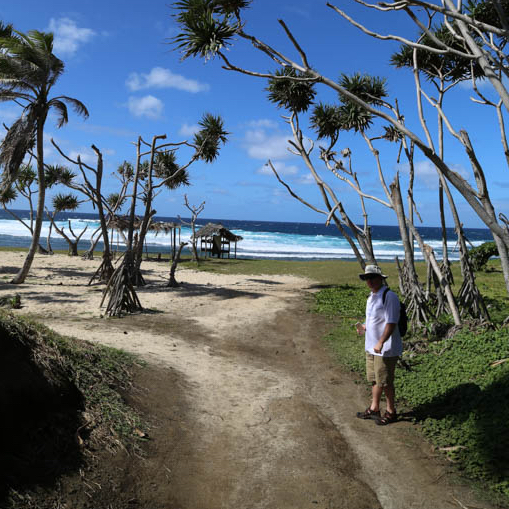
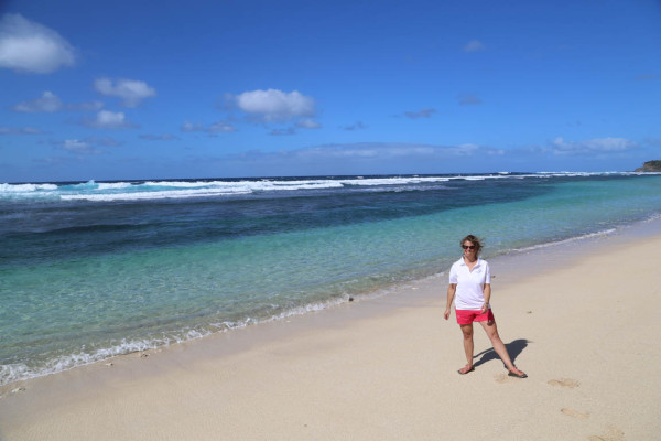
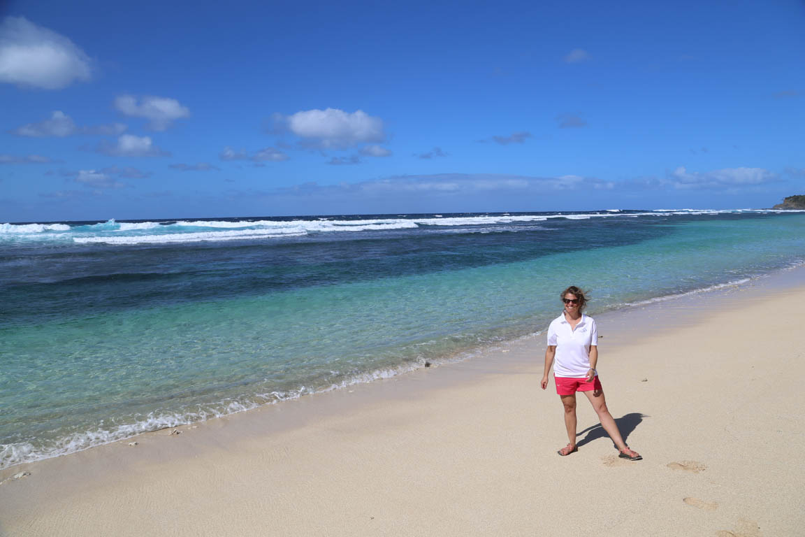
 French Guiana and Trinidad. Darren could probably single-hand Two Fish and Salwa was the first winner of the crew Small Footprint Award. My mantra for the previous two months had been, “when Darren and Salwa join, I don’t have to do any more work.” (note: Jason didn’t debunk that opinion until the day before they arrived.)